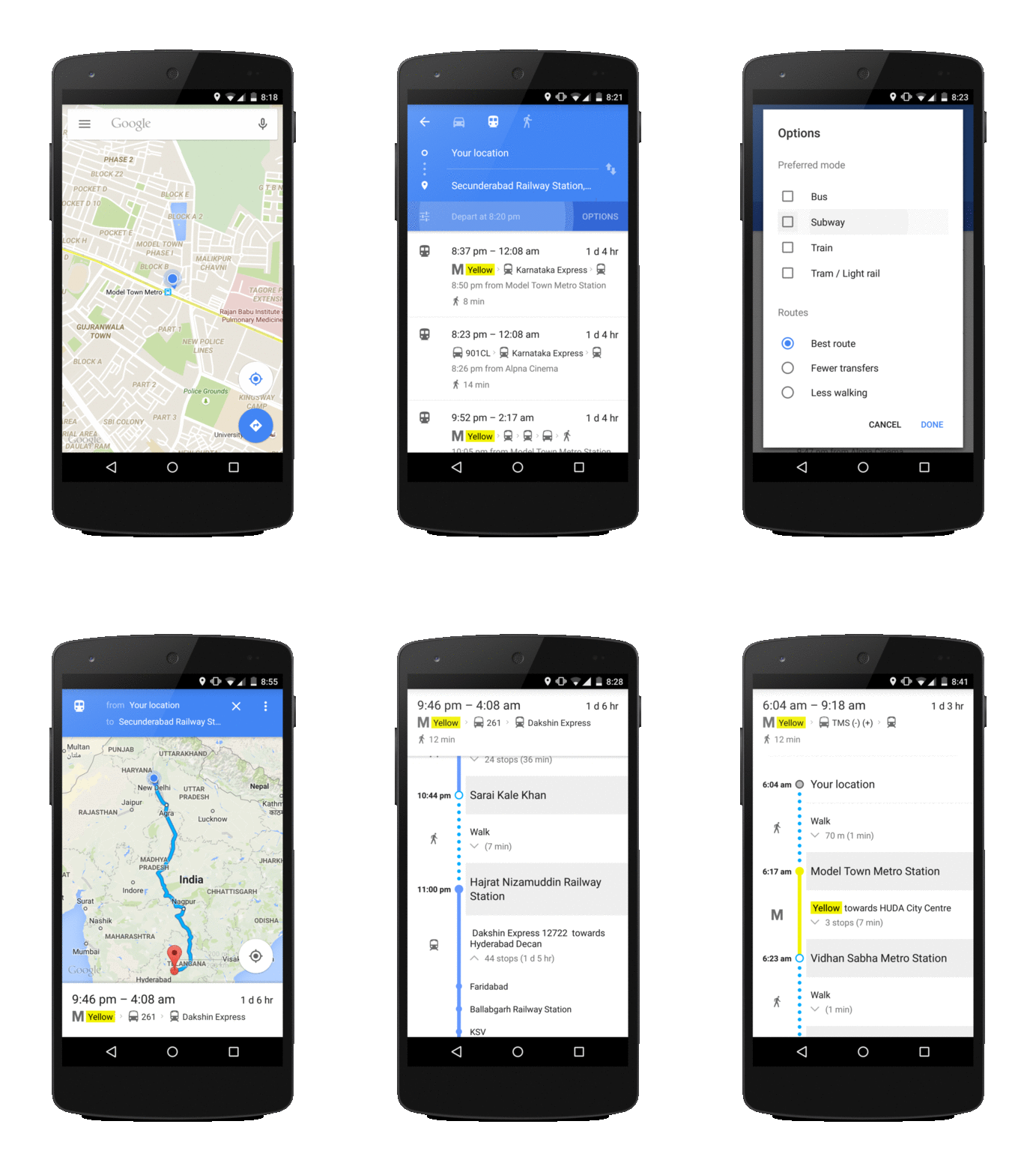
Sometimes planning trips to another city via public transport can be complicated. Should you catch the bus or the metro to the nearest railway station? Next time you’re planning a trip using public transport in India, Google Maps can help. From today you’ll be able to see Indian Railways schedules for 12,000 trains on Google Transit, as well updated bus and metro information from Ahmedabad, Bengaluru, Chennai, New Delhi, Hyderabad, Kolkata, Mumbai and Pune cities.
Google Transit is a feature in Google Maps which helps you plan your public transport trips quickly and easily. It is available on Google Maps on Android and iOS, as well as on desktop. To get started, simply type your destination into Google Maps, click on the “Get Directions” button, and then select the “Public Transit” icon to find which metro, train or bus options are available. Google Maps will then show you door-to-door directions to your destination using the public transport options available and walking directions to and from transit points making it easier to plan your trip.

Say you’re based in Delhi and going to visit your relatives in Hyderabad. You can choose if you’d like to take the metro or the bus to the nearest railways station, as well as the time you’d like to depart from Delhi or arrive in Hyderabad. Transit Mode will then give you point-to-point directions at the times you’ve said you’d like to leave at or arrive by to help you plan your itinerary the same way you would in real life.
Being able to see your entire train route and all the stops, means you know which stop is coming up next and roughly how far it is. And for those times when you want to see everything at a glance, the Schedule Explorer menu on desktop helps you easily see and scroll through all the options on the big screen.
We hope that these additions to Google Maps Transit will make it a little easier to plan your next trip.
Posted by Suren Ruhela, Director, Program Management, Google Maps